Geo-Mosaic for Environmental Monitoring


Back to Zhigang's Homepage | Computer Science | School of Engineering | CCNY

 A mosaic is a commonly used tool for representing the enormous amount of data generated from video sequences. In contrast to the usual application of mosaics as a user interface, the forestry environmental monitoring domain requires accurate geo-corrected mosaics tied to real-world coordinates. The standard techniques of generating seamless mosaics using only image data in a frame-by-frame image registration process has serious deficiencies over extended periods of time due to error accumulation, even when errors between two successive frames are very small. Our mosaics require both seamless registration of optical data, and the use of flight sensor data (geo-data) to provide a globally correct track of the motion to keep errors from propagating. A parallel- perspective projection mosaic representation (P3 mosaic) is proposed to represent the geo-corrected mosaic. Our complete mosaic method includes local registration, track generation, matching refinement, and a two-track-based mosaic composition.

Examples of geo-mosaic

AVI format, 8.7MB
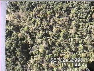
Forestry videos captured by a camera on the flight with GPS/INS/Laser Range data

Full-resolution JPEG Image: 618KB
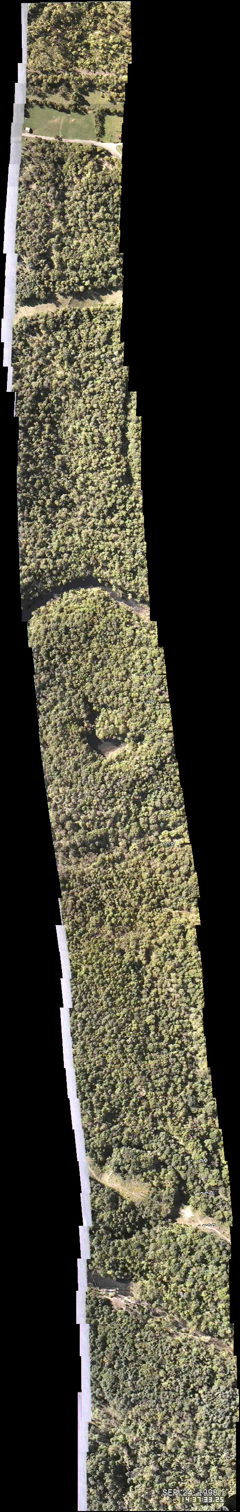
Free mosaic: Seamless mosaic, but not geo-corrected; Notice the accumulating error of scale
 

Full-Resolution JPEG Image: 974KB
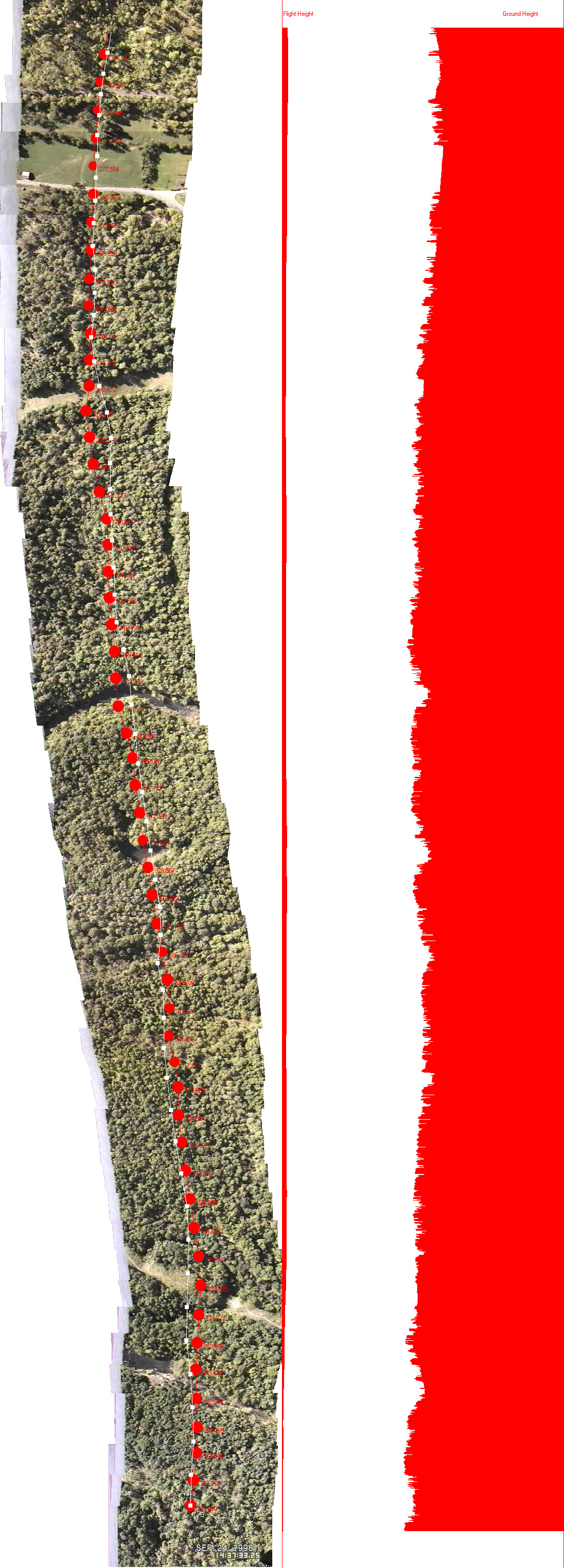
Geo-mosaic (P3 Mosaic): Seamless and geo-corrected
 

Full-Resolution JPEG Image: 1.07MB
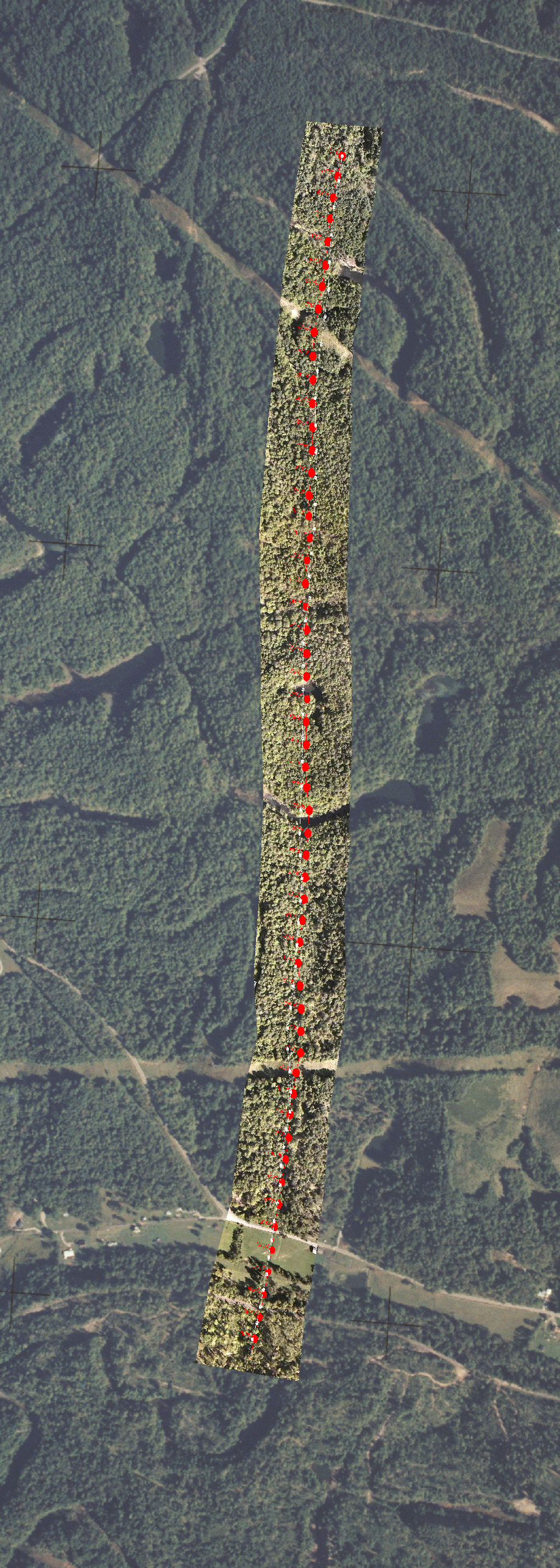
Geo-mosaic superimposed on high-altitude photo


Related  Publications:

  1. Z. Zhu, E. M. Riseman, A. R. Hanson and H. Schultz, An Efficient Method for Geo-Referenced Video Mosaicing for Environmental Monitoring.  Machine Vision Applications Journal 16(4), 2005, 203-126
  2. Zhigang Zhu, Allen R. Hanson, Harpal S. Bassali, Howard  J. Schultz, Edward M. Riseman, GENERATING SEAMLESS STEREO MOSAICS FROM AERIAL VIDEO, ASPRS 18th Biennial Workshop on Color Photography & Videography in Resource Assessment, May 16-18, 2001,  University of Massachusetts, Amherst (PowerPoint Represntation,4.8MB).
  3. Z. Zhu, A. R. Hanson, H. Schultz, F. Stolle, E. M. Riseman, Stereo Mosaics from a Moving Video Camera for Environmental Monitoring, First International Workshop on Digital and Computational Video, December 10, 1999, Tampa, Florida, USA, pp. 45-54(zhudcv99.ps, 2.2MB).
  4. Z. Zhu, E. M. Riseman, A. R. Hanson, H. Schultz, "Automatic Geo-Correction of Video Mosaics for Environmental Monitoring", Technical Report TR #99-28, Computer Science Department, University of Massachusetts at Amherst, April, 1999  (UMASSTR99-28.ps.gz, 3.34 MB).

Collaborators:

Department of Computer Science, UMass-Amherst:
Edward M. Riseman, Professor
Allen R. Hanson, Professor
Howard Schultz, Senior Research Scientist
Frank Stolle,  Ph.D. student
Chris Holmes, system programmer
Others:
Dana M. Slaymaker, Department of Wildlife and Forestry Conservation, UMass
Chris Hayward, graduate student, Department of Wildlife and Forestry Conservation, UMass

Supported by:
National Science Foundation Project (Grant Number EIA- 9726401), Automatic Interpretation of High-Altitude Image Data for Eco-System Modeling, $1,800,000, 02/01/98 – 01/31/01, PI (Riseman), Co-PIs (Hanson, Slaymaker)