NYC
has more than 1.7 million crashes from 1998 to 2007. As part of the NYC Traffic
Calming Measurement project, we have been working with the Office of Road
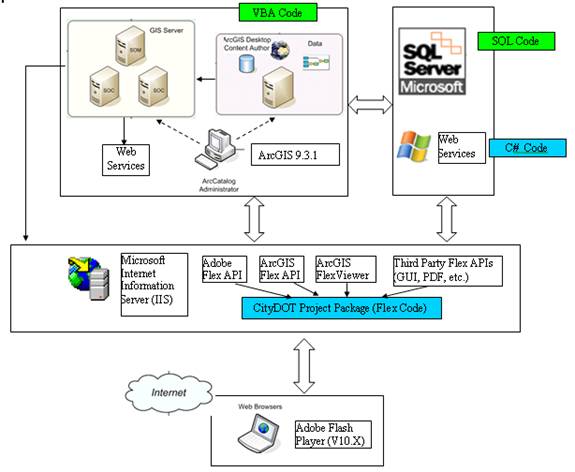
Safety at the NYC Department of Transportation (NYCDOT) to develop a Web-based
tool to efficiently manage crash records over the Web. In addition to the system architecture shown
below, a few snapshots are also provided to illustrate the functionality of the
Web-GIS application.
System
Architecture
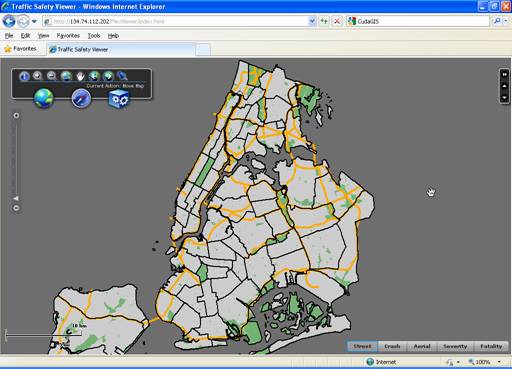
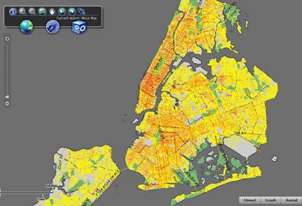
Snapshot
1: Overview
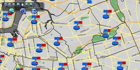
Snapshot
2: Visualizing Pie Charts of Aggregated Crashes among Community Districts
Snapshot
3: Mapping the Severity of
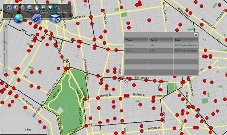
Snapshot
4: Querying Individual Fatal Crashes
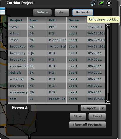
Snapshot
5: Managing Street Projects
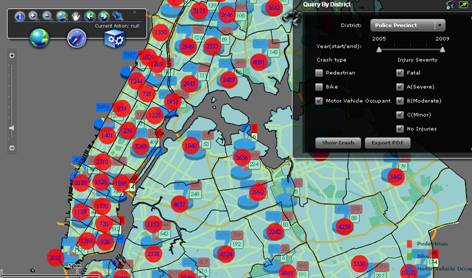
Snapshot
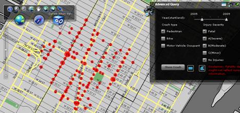
6: Dynamic query (based on crash type, injury severity and time) and zonal
aggregations
Snapshot
7: Dynamic query (based on crash type, injury
severity, time and interactively drawn polygon) of crashes at individual street
segments and intersections